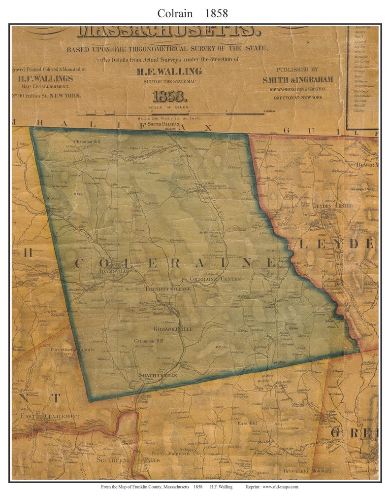
Coleraine (1858): http://www.old-maps.com/ma/ma_towns/franklin_towns/fk58/COLRAIN_1858_web.jpg
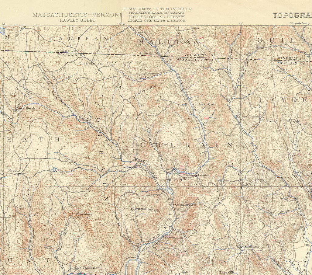
USGS Topographic map (1894) (Town boundaries are not shown on this map): http://www.old-maps.com/ma/ma_download_fk_towns/fk_oldtopos/05COL_1894_usgs_wb.jpg
Modern road map of Colrain: http://www.old-maps.com/ma/franklin_JonesMaps/05-col-dhj.jpg
_____________________
Old-Maps.com also has sets of same-size old town maps which are easier to overlay and compare when doing historical research. There is a complete set of these maps available to use at the Griswold Memorial Library. The set includes:
- Colrain circa 1780 (Ruby Austin's Lot Map): http://www.old-maps.com/ma/ma_Franklin_Overlays/franklin_50s/05_COL_FINALS_50_DPI/index.html
- Colrain 2001 (GIS Road Map): http://www.old-maps.com/ma/ma_Franklin_Overlays/franklin_50s/05_COL_FINALS_50_DPI/images/fullsize/fn_COL_2001_GIS-wb2.jpg.JPG
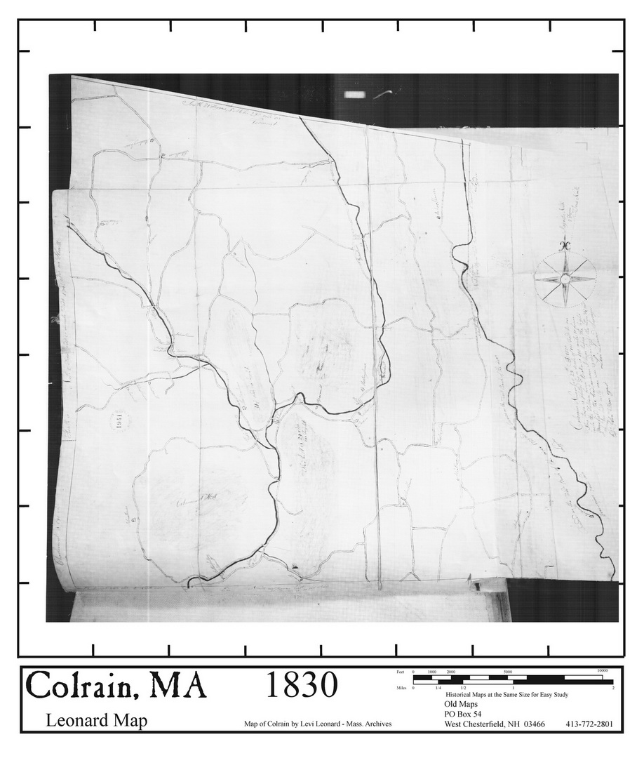
- Colrain 1830 (Leonard Map): http://www.old-maps.com/ma/ma_Franklin_Overlays/franklin_50s/05_COL_FINALS_50_DPI/images/fullsize/fn_COL_1830_Arch_Leonard-wb2.jpg.JPG
- Colrain circa 1800 (Colrain Sites): http://www.old-maps.com/ma/ma_Franklin_Overlays/franklin_50s/05_COL_FINALS_50_DPI/images/fullsize/fn_COL_1800_Town_Sites-wb2.jpg.JPG
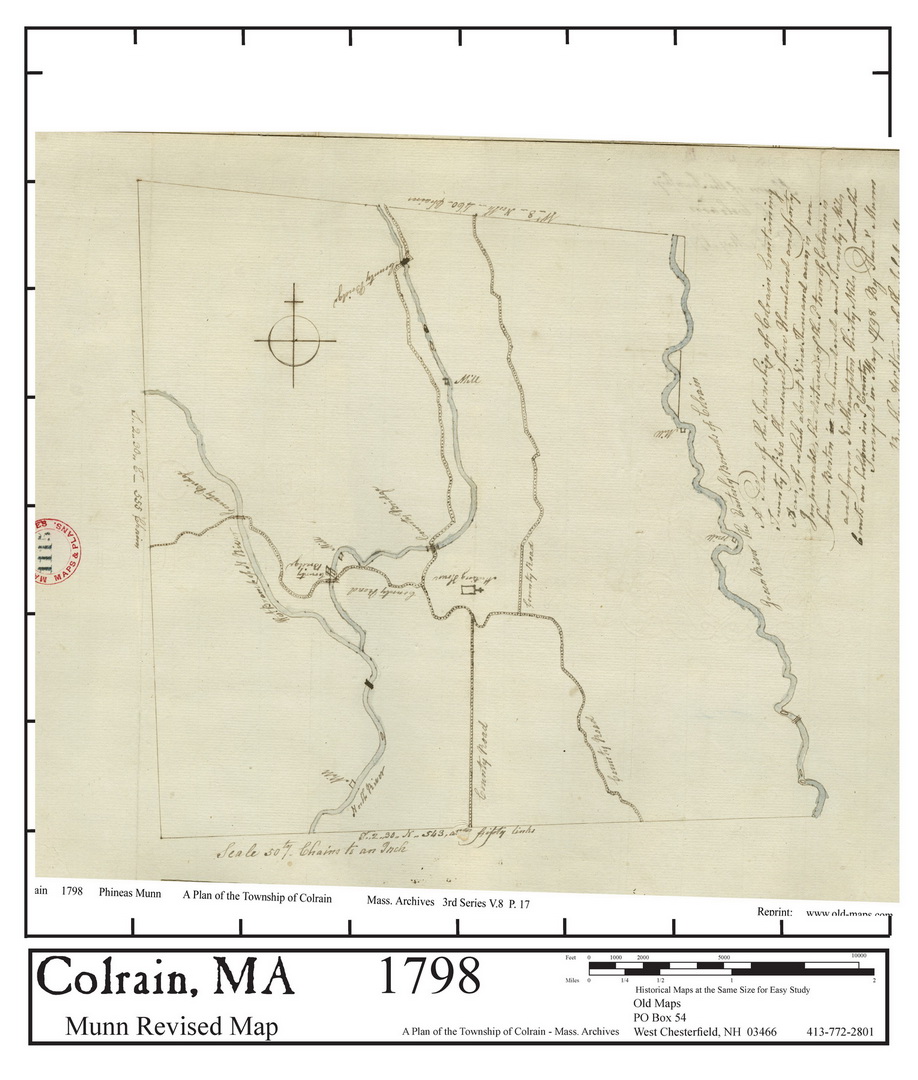
- Colrain 1798 (Munn Revised Map): http://www.old-maps.com/ma/ma_Franklin_Overlays/franklin_50s/05_COL_FINALS_50_DPI/images/fullsize/fn_COL_1798_Archives_Munn-wb2.jpg.JPG
- Colrain 1794 (Munn Map): http://www.old-maps.com/ma/ma_Franklin_Overlays/franklin_50s/05_COL_FINALS_50_DPI/images/fullsize/fn_COL_1794_Munn-wb2.jpg.JPG
- Colrain 1759 (Lotting Plan): http://www.old-maps.com/ma/ma_Franklin_Overlays/franklin_50s/05_COL_FINALS_50_DPI/images/fullsize/fn_COL_1759_Lotting-wb2.jpg.JPG
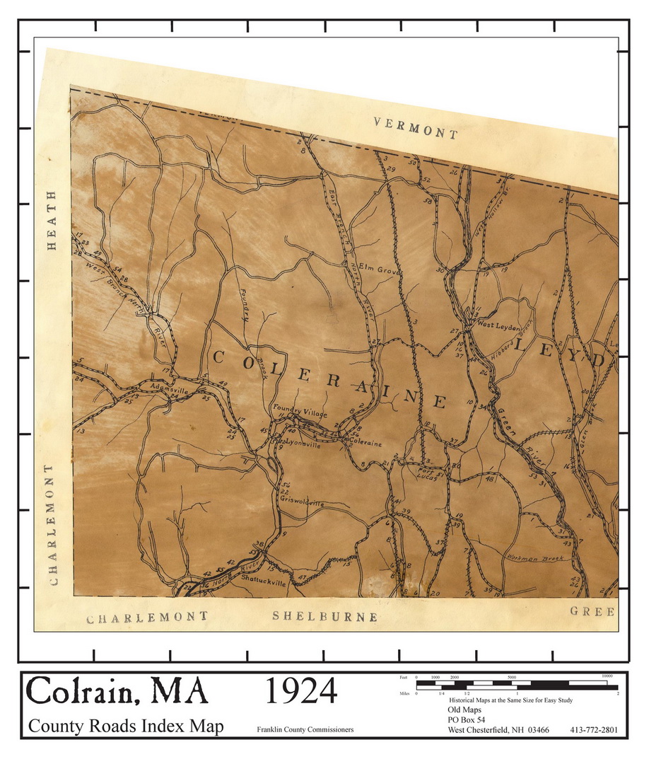
- Colrain 1924 (County Roads Index Map): http://www.old-maps.com/ma/ma_Franklin_Overlays/franklin_50s/05_COL_FINALS_50_DPI/images/fullsize/fn_COL_1924_Co_Rds-wb2.jpg.JPG
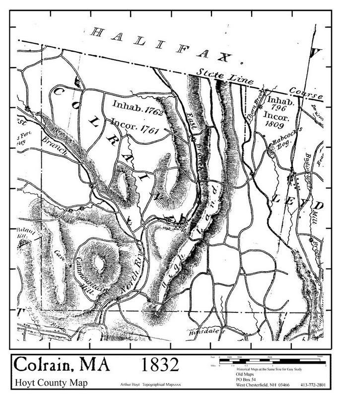
- Colrain 1832 (Hoyt County Map): http://www.old-maps.com/ma/ma_Franklin_Overlays/franklin_50s/05_COL_FINALS_50_DPI/images/fullsize/fn_COL_1832_Hoyt-wb2.jpg.JPG
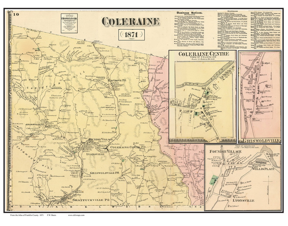
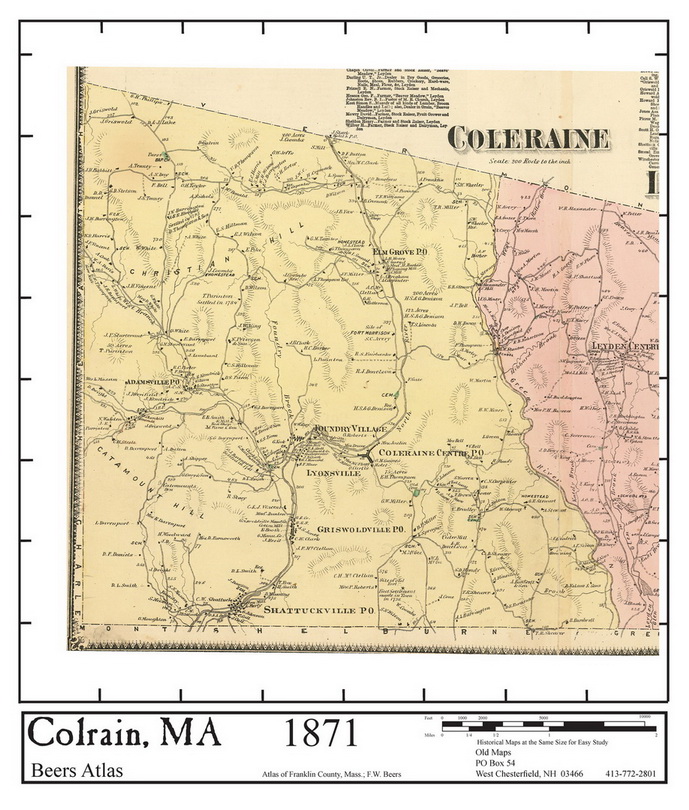
- Colrain 1871 (Beers Atlas): http://www.old-maps.com/ma/ma_Franklin_Overlays/franklin_50s/05_COL_FINALS_50_DPI/images/fullsize/fn_COL_1871_Beers-wb2.jpg.JPG
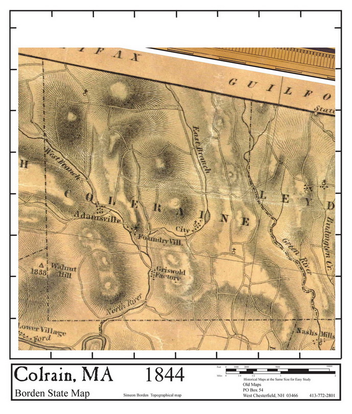
- Colrain 1844 (Borden State Map): http://www.old-maps.com/ma/ma_Franklin_Overlays/franklin_50s/05_COL_FINALS_50_DPI/images/fullsize/fn_COL_1844_Borden-wb2.jpg.JPG
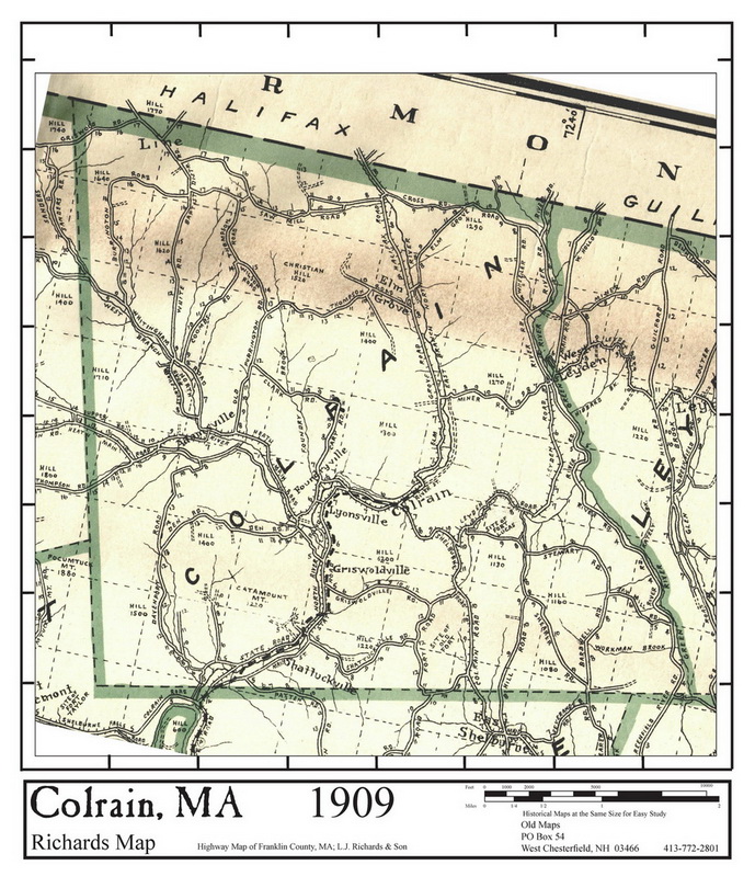
- Colrain 1909 (Richards Map): http://www.old-maps.com/ma/ma_Franklin_Overlays/franklin_50s/05_COL_FINALS_50_DPI/images/fullsize/fn_COL_1909_Richards-wb2.jpg.JPG
- Colrain 1858 (Walling Map): http://www.old-maps.com/ma/ma_Franklin_Overlays/franklin_50s/05_COL_FINALS_50_DPI/images/fullsize/fn_COL_1858_Walling-wb2.jpg.JPG
- Colrain 1974/1978 (Topographic Map): http://www.old-maps.com/ma/ma_Franklin_Overlays/franklin_50s/05_COL_FINALS_50_DPI/images/fullsize/fn_COL_1974-98_USGS-wb2.jpg.JPG
- Colrain 1894 (Old Topographic Map): http://www.old-maps.com/ma/ma_Franklin_Overlays/franklin_50s/05_COL_FINALS_50_DPI/images/fullsize/fn_COL_1894_USGS-wb2.jpg.JPG